Thursday, July 26, 2018

Alaska Redux part 6


Our escape from Haines occurred early Tuesday morning as we had a long drive ahead of us. Our destination for today is Beaver Creek taking us back through British Columbia and Yukon. So we lost an hour because both BC and YT are on Pacific daylight time while Alaska is on Alaska daylight time. Why they change to daylight time doesn’t make any sense since the sun hardly ever sets this time of year. I did discover that it is fairly dark between midnight and 3 a.m.


There’s only one road into Haines so as we left we again followed the Chilkat River. (This is different from the Chilkoot River where Rob and Steve were fishing.) I might have mentioned before the Chilkat River is part of the Alaska Chilkat Bald Eagle Preserve and is where more than 3500 eagles return to in the fall. We did not see any eagles along this stretch of road, but they were plentiful in the harbor and along the ocean front.
Construction slowed us down for a while. We were able to watch the process as the huge “dinosaur-like” equipment ate away the escarpment and chewed up stately pines, or alders, or spruce…anyway, big trees.


Passing through Canadian customs was a breeze, not so for the pickup truck in front of us. They were pulled over for an inspection and all the occupants told to exit the vehicle (4 or 5 plus a dog). Random check or a problem detected, we’ll never know. We’ll have to go through U.S. Customs again on our way to Tok from Beaver Creek. Citrus was on the restricted list before so grapefruit for breakfast before customs.

At Haines Junction we made a left turn to continue in a northwesterly direction. (A right turn would have taken us back to Whitehorse.) The road is much improved over our previous visit 11 years ago, but frost heaves were still evident in many places. One section along Kluane (rhymes with Swanee) Lake was under construction 11 years ago and took 1 ½ hours to transit.

Kluane Lake is the largest lake in Yukon covering about 400 square kilometers (154 acres).  Around 3-400 years ago a glacier advanced across the Slim’s River and closed the drainage outlet for Kluane Lake. As the water level rose the lake’s drainage reversed causing water that previously drained into the Gulf of Alaska to drain into the Yukon River system and ultimately into the Bering Sea.


Our ultimate destination for the next leg of our trip is Valdez, however our plan is to take three days to get there. Our first stop was Beaver Creek, Yukon. We stayed at the Discovery Yukon RV Park a very nice park with wide level sites. We had the option to have dinner at the small restaurant on the grounds, operated by the owners of the park. We passed because we had already planned our dinner. The owner brought us two large bags of greens she had harvested earlier that day.


The second stop on the way to Valdez was Tok and brought us back into Alaska. Rob and I had stayed at the Sourdough Campground on our first trip to Alaska 11 years ago. Although the park has new owners, it is much the same as before. Sourdough pancakes and elk sausage were still on the menu for breakfast and a pancake toss an evening activity (to win a free breakfast). The cost of the breakfast was a lot more expensive than I remember it, however.

The final stop was in Gakona at the appropriately named Gakona Alaska RV Park, located on the Gakona River. Wide open spaces look out over the river.

We learned that, up until a few years ago, the bank of the river was much closer to the park. The river has since changed course meandering further away from the park.
The staff was full of information regarding fishing in the area and tantalized Rob and Steve with a gift of frozen salmon. The fish had been caught in a fish wheel co-owned by the park owners and several others. As soon as Rob and Steve had the coaches connected they put their fishing gear together and took off for the perfect spot. Sadly, they came back hours later with no catch. 


Meanwhile, Gerri stayed back preparing a substitute meal of macaroni and cheese and hot dogs. The weather has been outstanding with temperatures in the 70’s and bright sunshine, so we ate outside after covering ourselves with bug spray.

Later in the evening Mark, one of the staff, invited us to go observe the fish wheel. All four of us piled into his truck for the ride down the road and over a secluded path cut through the forest. Two fish had already been captured when we arrived. We watched for about ½ hour but no more fish showed up. The river was running very fast. 

After Mark took us back to our campsite he gave one of the fish to us. Rob dutifully took out his filet knife.


The road we followed to these three parks was designated a Purple Heart Hwy. There were so many potholes, and frost heaves, the road should be awarded a Purple Heart. Tests are being conducted to determine if the  The rough road made for slow going which gave us a chance to enjoy the beautiful scenery.

We left Friday following the Gakona River south until it merged with the Copper River. We turned south onto the Richardson Hwy towards Valdez. The Trans-Alaska Pipeline parallels the Hwy and the border of the Wrangell-St. Elias National Park and Preserve. There were a few sections of pipeline visible through the trees.

The Wrangell-St. Elias mountains were also visible. Mt. Wrangell is classified as an active volcano because of the rounded top. It is the largest active volcano in the mainland United States with 4 times the volume of Mt. Rainier. Eruptions over the last century have left ash on its slopes and heat from magma below the surface has melted parts of its glaciers. On a clear day you can see steam rising from vents at the top.


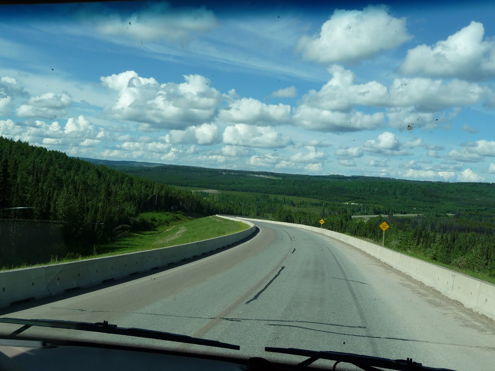
 The scenery in this area is stunning! The weather couldn’t have been more cooperative. The sun was shining, no wind, and a vibrant blue sky dotted with fleecy clouds.


The mountains seemed to wrap around the road giving the impression of driving through the cauldron of the volcano. Snow and ice melting off the glaciers created waterfalls against the dark rock and tree covered slopes.


As we crested the summit, the clear blue sky gave way to dense fog. We had arrived in Valdez.


Monday, July 16, 2018

Alaska redux part 5


Have not had internet access, satellite, or phone service all the way through the Rockies. As we approached Whitehorse our phones started pinging finally uploading texts and alerts collected over the last several days.

Whitehorse, the capital of the Yukon, lies on the banks of the Yukon River. It has a population of about 26, 400. Historically, the Yukon River was a main source of transportation to the area until 1942 when the Alaska Hwy was completed. Whitehorse has services comparable to a much larger city including Walmart. It also has traffic and stoplights.

As with many Walmarts, the parking lot sported many RVs camping out. We stopped there in search of a filter for Jeannie’s new camera. While here we were able to re-provision, do laundry, scout out some of the shops and restaurants, and Rob and Steve played golf. What we couldn’t do is wash the car or coach. The one car wash was closed for remodeling. Whitehorse is on the main approach to Alaska and as such it would seem to be a perfect location for an industrious entrepreneur to invest in an automated car wash. Geesh! We can’t even tell what color our car is.

After much discussion regarding the mileage from Whitehorse to Haines, AK, our next stop, we decided to go for it, scrapping an interim stop in Otter Falls. We were able to extend our stay in Haines at the Ocean View RV Park which is located on the Chilkoot Inlet of the Lynn Canal between Skagway and 
Juneau.
 At the intersection of the Alaska Hwy with Haines Junction we turned south towards Haines. This route took us through scenic coastal forests, glaciated mountains and alpine tundra. It was quite evident we were in bear territory based on the frequency of scat deposited on the road. Didn’t someone once say “bears don’t ‘poop’ in the woods?


After passing through Customs

we followed the Chilkat River, home to the Chilkat Bald Eagle Preserve. It is 40 miles from Customs into Haines and a good portion of the highway is under construction, thus limiting our speed. Big chunks of the granite escarpment are being removed, hopefully to widen the narrow road into Haines. We later found out that the road is being widen to be able to accommodate the large trucks that will be transporting gold ore from a new mine that will soon be opening up.
Haines is a small town with a population of just over 2500. The original name, Dtehshuh meant “end of the trail” and referred to the place where local Chilkat and Chilkoot Indians traded with Russian and American ships. In 1879 a Presbyterian mission and school was built and in 1881 the name was changed to Haines for Francina E. Haines, secretary of the Presbyterian Women’s Executuve Society of Home Missions. In 1904 Fort William H. Seward was established honoring the secretary of state who purchased Alaska from Russia in 1867. This was the first permanent Army post in the territory. It was deactivated in 1946 and sold. Today the original buildings house private businesses and homes.

Rob and I have stayed at this RV park before, but in the 11 years since we were there, the park has been significantly enlarged. The only spaces with hookups still back up to the road.

The rest of the new space is available for dry camping. The park is next to a small boat harbor and the pier where cruise ships dock. As luck would have it, a ship was in port when we arrived. Later that day another cruise ship was heading out from Skagway further up the canal. Skagway seems to be a popular stop for cruise ships with as many as three a day sailing past us.


Haines boasts a large population of American Eagles and we weren’t disappointed. Several, both adult and juvenile, were perched on the jetty into the harbor or on pilings, or in tall conifers, or just flying around.


Day two we ventured out to the fish processing plant to learn how it’s done. We were fortunate to find a boat had just come in loaded with a catch of Chum and Silver Salmon. This boat was used to transport large containers of fish that it would pick up from the smaller boats that are actually doing the catching. 
The containers are then brought in to this processing plant.
The fish are dumped into a huge bin with a shoot that “shoots” the fish into the processing plant. We were able to watch the process through windows. The fish are positioned head first on a conveyer belt. They proceed through a guillotine which chops off their heads.  Next they are lined up perpendicularly on the conveyer belt where they are gutted. Then they are washed out and sent down the line to be sorted. Eventually they are boxed and shipped. Mostly young people, high school or college age, were working the conveyer belt along with a few more seasoned workers. Signs next to the windows explained the process and also described machines that fileted and de-boned the fish, but those machines weren’t being used that day.
Friday, the 13th, was a beautiful sunny day. Up until then we had had overcast days with occasional sprinkles. Rob and Steve decided to make use of their fishing licenses when the tide started coming in that afternoon.


Jeannie and I followed them down and took some pictures.


The end of the river is quite rocky perfect for salmon spawning. Activity was slow so no fresh salmon for dinner. A counting bridge spans the river a little further from the fishing spot. The fish are counted and identified as they pass through a weir under the bridge. I presume this is done electronically, however, there is a person sitting out on the middle of the bridge watching over things. At least, I don’t think he’s counting them one by one. Not sure I’d like his job.

Saturday was cold, windy, and overcast. A good day to stay inside. Wifi has been miserable, sometimes working then cutting out just when we needed it. Then we found out we could buy inexpensive service from a local company. What a difference…3 days or 3GBs was slightly over $12. I was finally able to post the preceding blog!

Sunday, cold, windy and rainy again! Despite the weather we decided to take another ride and check out the fish count for the day. Then we wound around the higher rent district to see how the other half lives. Nugget went for a ride with us. He is afraid of riding in the car and got carsick on the curves. We had to take him home where he recuperated with a couple of pieces of doggie jerky.

Dinner was planned to be “out” and as there is only one restaurant that’s where we went…The Pilot Light. It’s a sister restaurant to a pizza place we went to for lunch a couple of days ago. Very limited menu featuring several seafood dishes and a few game items. Steve opted for an elk burger, Jeannie had a salad out of local greens and rockfish tacos, Rob had nachos and a bowl of salmon bisque, I had a bowl of salmon bisque and halibut enchiladas. Steve also ordered of bread…home baked, crunchy sourdough bread. Total yummy. Jeannie, Rob and I have leftovers for lunch tomorrow. While we were waiting for our meal the couple dining at the table next to us got up and cleared a vacant table. Steve asked if we were supposed to bus our own table when we’re through eating. The couple laughed…they are parents of the owner. Of course, being local, Rob and Steve grilled them on places they should go to fish. We were also advised to go to the Kroschel Wildlife Center. We’ll have to do some research, but sounds good. After taking our leftovers back to the coaches, Steve, Rob and Jeannie took a ride back out to the river to check the final fish count for the day. They came back with pictures of a couple of bears that had descended for dinner, but still not an impressive fish count.
Tomorrow we leave Haines and head back up the Haines Hwy through British Columbia, the Yukon, then back into Alaska. Our ultimate destination is Valdez, but we will have three short stops on the way and most likely no internet.


Saturday, July 14, 2018

Alaska 2018 part 4


Leaving Fort Nelson B.C., we began to climb, winding our way west into the Northern Canadian Rockies. Our destination was about halfway between Ft. Nelson and Watson Lake. Milepost (the bible for travelers on the Alaska Hwy) warned several times to watch for Stone Sheep, Caribou, Bear and Moose. In one area a flashing road sign alerted us to an area frequented by Stone Sheep. As we rounded a curve a ram was casually walking down the road. He quickly disappeared into the brush, but just around another bend was a small herd with three babies.
They were nibbling at something on the edge of the road. I couldn’t see any vegetation so they must have been eating pebbles. I guess that’s why they’re call Stone Sheep. (Actually, they like the salt deposits on the roadway, some natural and some artificial). The side of the road they were on was atop a very steep and rocky cliff. They have an amazing ability to climb rock walls.


The remainder of the road into Toad River was steep and windy.

We seem to always be following a river. This one is probably the Muskwa (it means bear). The Muskwa will merge with another river which will merge with another river, and so on, and eventually end up in the Arctic Ocean.

And again, traffic was a nightmare.

It’s a good thing we had reservations. The Toad River Lodge was very busy with RVs parked in every direction in the area reserved for new guests making maneuvering difficult. Both Steve and Rob are excellent drivers and were able to navigate to our spaces without incident. 


They soon set to repairing Steve’s right rear brake light which had stopped working. Seems like there’s always something to fix.


The lodge is near the base of the Canadian Rockies next to a large pond.

Campers told us a moose had come down to the pond at dusk the night before. Keep in mind, dusk is around 11 p.m. Another camper swore he had seen something moving on the slope “over there”. That turned out to be a slope about a mile away. We couldn’t make out anything with binoculars, so we got out one of our scopes. All we saw was rocks and trees. Notice how clean the car is. NOT!


We finally gave up by 10 with no moose sighting, but we did watch 2 Trumpeter Swans gliding around on the pond and 2 beavers moving logs to their lodge.
That's the lodge in the center of the darker spot
Next morning I took Nugget out before 5 and checked around the pond for the moose. No luck! But then, later in the morning, another camper came by to tell us there is a moose having breakfast in the pond. Cameras at the ready, we headed over to see. Sure enough there was a large one (aren’t all moose large?). Bullwinkle was partially hidden behind some tall skinny poplars munching away on pond vegetation. Apparently he didn’t like all the attention, even tho’ he was quite a distance away, because he quickly disappeared into the scrubs. A short while later he reappeared in another spot (or it was his cousin) and stuck around awhile. We figured we would probably see more moose in Alaska so we decided to move on to Watson Lake.


For this stretch of the Alaska Highway Milepost added bison to the list of wildlife to watch out for. There’s a section of about 100 km that is their preferred bailiwick. We saw several together as well as bachelors lounging along the side of the road.

One young caribou interrupted his grazing to make haste out of the area as we passed him. Stone sheep were hanging around rocky cliffs and a couple of young black bears were filling up on vegetation next to the road. The verge is a popular place for food, perhaps because there’s no competition from trees. The roadsides are kept clear of trees for 20-30 feet from the edge allowing grasses and flowers (I’d call them weeds) to flourish.

Our next campsite, “Baby Nugget RV Park”, is just past Watson Lake in Yukon Territory. On the way, we passed Muncho Lake (“big lake” in Kaska language) one of the largest natural lakes in the Rockies. It is blue/green in color due to the copper oxide leaching into the lake


Milepost and stone marking the border between BC and YT.


We’re here for two nights, just long enough to check out the Signpost Forest and give the guys a chance to wind down.

The Signpost Forest began   in 1942 when an Army soldier working on the Alaska Highway posted the first sign. Today it's over 85,000 and growing!  Of course we had to add ours. Rob had to do a little rearranging, but he found a spot.

We’re staying just west of Watson Lake at the Baby Nugget RV Park in Nugget City. It is a large park, popular with RV caravans.
This guy was just outside our door while we were stopped to register. Nugget took one look at him and shied away. He wasn’t too sure he wanted to get too close.
  
This unique “RV” pulled in just after us. It is a caravan all by itself. Each of those small squares is a sleeping space for up to 25 passengers. Seems like it would sort of be like sleeping in a coffin. It parked away from all other RVs and the occupants kept to themselves, except the used the park’s restroom facilities. The sides of the vehicle slide out providing a “living” space and kitchen facilities. They put out an awning on one side with chairs so the guests could sit outside. Based on wording on the rear I’m guessing it is German made.

This park is cut out of forest habitat and biting bugs were plentiful. Jeannie and I seemed to be their favorite food source. Despite using bug spray, several found their way to my neck causing at least 8 painful, itchy welts.

For a little break from cooking our own meals we decided to try the Wolf It Down restaurant and were we pleasantly surprised.
Steve had a buffalo burger, Jeannie chose a hamburger steak, I had chicken vegetable stir fry and Rob had pizza. To top off our delicious dinners we opted for fresh baked pie. Rob and Steve chose apple while Jeannie and I had Bumbleberry, topped with vanilla ice cream, of course. We didn’t eat there the second night, but we did go back for dessert.

We left early Sunday for Teslin, YT. This part of the Alaska Hwy would take us back across the border with British Columbia 6 times before finally staying in YT. The trip was uneventful, just more beautiful scenery.


The highway crosses the second longest bridge on the Alaska Hwy at 1917 feet. Teslin sits on a bay formed by the Nisutlin River where it flows into Teslin Lake. Teslin has a large native population of Tlingit, First Nation who celebrate their ancestors’ way of life and are committed to preserving their history. We visited the Teslin Tlingit Heritage Centre which has displays featuring 200 years of Inland Tlingit history.

Our next stop, July 9, was Whitehorse. We made good time and were able to spend the afternoon doing some shopping. Rob and Steve opted to play golf on Tuesday while Jeannie and I did laundry and catch up on the internet (which we haven’t had for over a week).